Using satellite imagery to monitor remnant pools in the Barwon-Darling River (Baawan-Baaka)
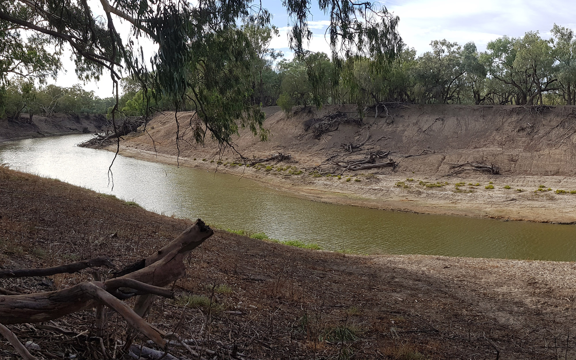
The very low flows in a river system provide the minimum level of flow required to protect and maintain aquatic ecosystems. During the 2017-2019 drought extended dry conditions resulted in a long low flow and no flow period in the Barwon-Darling River. This resulted in isolated remnant pools in the river system, which provide refuge for a range of plants and animals. Many of these were downstream of Wilcannia where there is no flow monitoring gauges and access is difficult. The NSW Government temporarily restricted access to water for much of 2019 due to the threat to public health and safety, and to manage water for environmental purposes, specifically protecting drought refuge habitat and connectivity.
The Water Science team used remote sensing from satellite imagery to
- quantify the contraction of remnant pools in this river reach during the drought in 2019, and
- identify the level of downstream connectivity and pool area responses to a small protected flow pulse in the Barwon-Darling River downstream of Wilcannia after a no flow period (Figure 1).
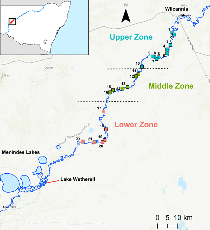
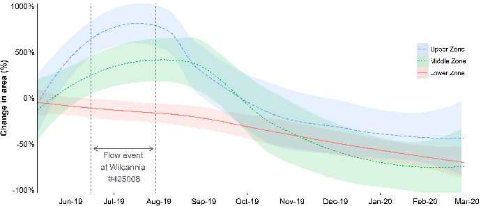
Remnant pools in the Wilcannia to Lake Wetherell reach were contracting rapidly prior to the small event which occurred between June and July 2019 (~3 GL and peaked at 283 ML/day). This event was sufficient to connect remnant pools between Wilcannia and at least 150km downstream, but did not connect to Lake Wetherell. By the end of February 2020 and after more than 200 days of no flow, the average areas for upper, middle and lower study area had contracted to 15%, 13% and 37% of their peak size after the June-July 2019 flow (Figure 2).
Our work highlights the potential of remote sensing techniques for monitoring connectivity in arid landscapes, especially during drought and low flow periods. It also supports the significance of protecting low flows to provide low levels of connectivity and replenish remnant pools in the river channel. Without the temporary water restriction in place, the level of hydrological connectivity and pool replenishment may not have been achieved. We also show that restricting access below the amended low flow daily access rule (455 ML/day) in the Barwon-Darling Water Sharing Plan should provide connectivity throughout most of the river reach.
Report
Learn more about remote sensing of pool contraction and connectivity in the Barwon-Darling (Baawan-Baaka) during 2019-20.
Download the report (.PDF 1730KB)