Floodplain management listening tour kicks off
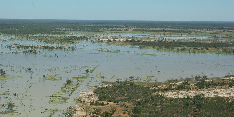
The NSW Government is calling for photos, drone footage and historical data from last year’s record flooding and previous years to underpin vital floodplain management plans being updated in the Murray, Murrumbidgee, Billabong Creek and Lachlan valleys.
Executive Director of Water Planning Giselle Howard said floodplain management plans are a key tool for improving the environmental health and connectivity of floodplains as well as increasing awareness of risk to life and property from the effects of flooding.
“Some of these existing plans are over 10 years old and out of date which is why we’re asking the public’s help to ensure they’re properly reshaped and up to scratch with the latest data to help put us on the front foot for the next flood event,” Ms Howard said.
“This important work builds on our successful floodplain management reforms in the Northern Basin and helps improve the way we consider the impacts of floodplain structures on the environment, cultural values and other landholders.
“It was only six months ago that many of these southern Murray Darling Basin communities were inundated with water, so it makes sense to visit them in person, hear their firsthand experiences and leverage their valuable insights.
”The community consultation sessions will be held over the next three weeks in 12 towns including Jerilderie, Deniliquin, Moama, Barham, Forbes, Condobolin, Lake Cargelligo, Hillston, Narrandera, Darlington Point, Hay and Moulamein.
“We want people to come along and bring their best images, footage and other information from both the recent and historic floods over the years which will be used to develop and calibrate our hydraulic models that underpin the plans,” Ms Howard said.
“This is a complex topic which is why we are streamlining them from ten plans to four with clearer language, state-of-the-art modelling, improved imagery and properly mapped out ecological assets and areas of Aboriginal cultural significance.
“Importantly, the updated boundaries for these four plans will cover whole floodplain valleys rather than the current localised areas to ensure the rules for flood work approvals are consistent for all landholders.”
To find out more and register to attend a session, please visit Southern Floodplain Management Plans