About the Murrumbidgee
The Murrumbidgee catchment is in southern NSW. It is bordered by the Great Dividing Range to the east, the Lachlan catchment to the north, and the Murray catchment to the south.
The catchment has an area of 84,000 square kilometres, with elevations ranging from over 2,200 metres to the east, to less than 50 metres on the western plains. As a result, the climate is diverse, ranging from the alpine conditions of the Snowy Mountains to the semi-arid conditions of the Riverina plains.
Rivers and tributaries
The Murrumbidgee River is a major tributary of the Murray-Darling River system. It spans almost 1,600 kilometres and drains much of southern NSW and most of the ACT. The Murrumbidgee rises in the Monaro Plains near Cooma and flows westward towards its junction with the Murray River near Balranald.
The Murrumbidgee is regulated downstream of Burrinjuck Dam, with the Tumut, Gudgenby, Naas, Molonglo, Queanbeyan, Cotter and Yass rivers as key tributaries.
The Tumut River is the Murrumbidgee's largest tributary. It is regulated downstream of Blowering Dam and is part of the Snowy Mountains Hydro-electric Scheme.
Water storages
The 2 largest storages in the Murrumbidgee catchment are Blowering Dam, with a capacity of 1,628,000 megalitres, and Burrinjuck Dam with a capacity of 1,026,000 megalitres.
Talbingo Dam, at 920,550 megalitres, is the largest dam in the Snowy Mountains Scheme. Tantangara Dam, with a capacity of 254,080 megalitres, and Googong Dam, with a capacity of 125,000 megalitres, are also major dams within the catchment area.
Towns
The national capital, Canberra, and Wagga Wagga, the largest inland city in NSW, are in the Murrumbidgee catchment.
The catchment also supports several regional cities and towns including Balranald, Cooma, Cootamundra, Griffith, Gundagai, Hay, Junee, Leeton, Narrandera, Queanbeyan, Tumut and Yass.
Water users
The majority of land use in the Murrumbidgee catchment is for extensive agriculture. Grazing, the largest industry, uses 64 per cent of the catchment.
Major water users include local councils and water utilities, forestry, tourism, and agriculture, including rice, dairy, wool, wheat, beef, lamb, grapes and citrus.
The Lowbidgee floodplain covers an area of over 2000 square kilometres in the catchment area. It contains the second largest river red gum forest in Australia.
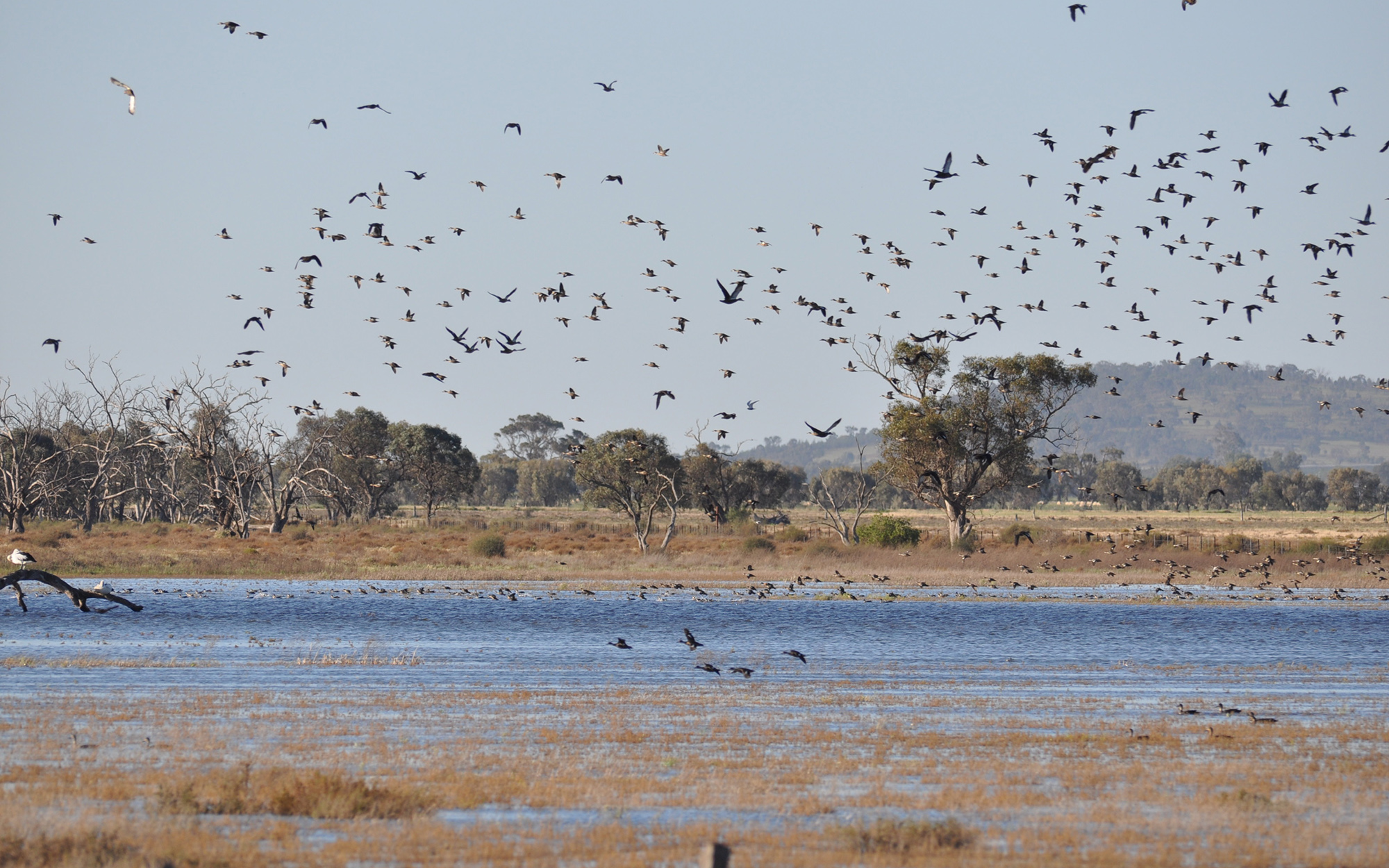
Extensive lignum swamps in the catchment are breeding habitat for large numbers of waterbirds. A part of the wetlands is conserved within Yanga National Park, the largest conservation area on the Murrumbidgee floodplain.
The Ramsar-listed Fivebough and Tuckerbil Swamps, near Leeton, are wetlands that support diverse waterbird species, especially migratory waders.
The upper Murrumbidgee supports one of the last self-sustaining natural populations of the endangered Macquarie Perch in the Murray-Darling Basin. It contains the longest stretch of river in the Basin that supports this species.
Sharing water fairly between competing water users and the environment, and between states, is a key water management issue, particularly during drought. The Murray-Darling Basin plan sets rules which govern how water is shared in the catchment, as does the water sharing plan for the Murrumbidgee.
Other issues include the alteration of natural river flows through the construction of dams and weirs. Erosion from land clearing affects riverine health and contributes to water quality problems, such as salinity.