About the monitoring projects
The department uses monitoring and research projects to track if changes in water management protect and improve water-dependent environments. We have obligations to report on the environmental outcomes in NSW.
To enable this, the department has developed the Environmental Outcomes Monitoring and Research Program (EOMRP). This ensures that science-based decision-making is used to manage surface and groundwater water environments.
What are we monitoring?
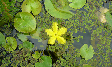
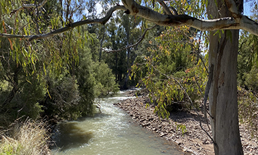
We are working together with researchers, universities, and other government agencies to study how flows affect river resources such as nutrients, aquatic insects, native vegetation, fish, frogs, and turtles. We undertake monitoring across NSW in both inland and coastal catchments.
The Environmental Outcomes Monitoring and Research Program has 5 main themes:
Connectivity from rivers to floodplains.
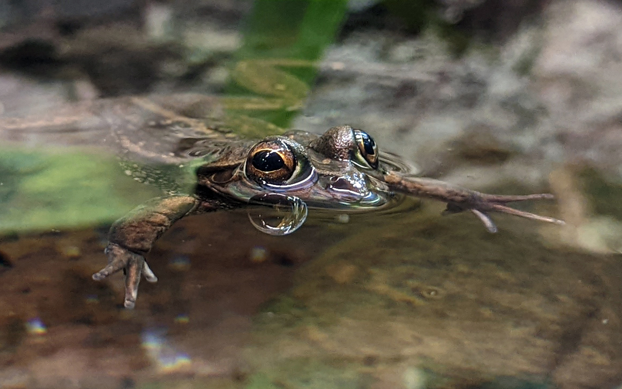
Native fish, turtles, frogs, invertebrates, mammals and waterbirds.
Resources and nutrients required to support aquatic health.
Native riparian, floodplain and wetland vegetation.
Environments that depend on groundwater to survive.
Why do we monitor changes?
One of the key drivers of environmental outcomes in surface water environments is river flow. In particular, the location, magnitude, timing, frequency and duration of river flows affect environmental outcomes.
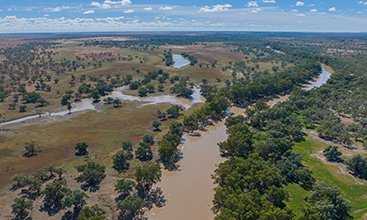
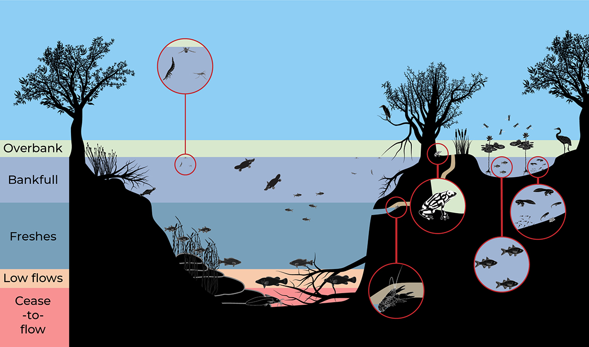
These river flows can be broken into broad flow categories, which include cease-to-flows, low flows, fresh flows, bankfull, and overbank flows (Image 1). Each flow category can influence a range of habitats and organisms. In NSW, how river flow is managed is driven by the Basin Plan (2012) and the water sharing plans developed under the NSW Water Management Act (2000).
Our monitoring and research projects evaluate and report changes in surface water environments. The EOMRP will improve our ability to assess the effectiveness of water sharing rules and water management in NSW. This research will help us ensure that rivers are managed sustainably, and that the health of our water environments is maintained or improved.
Environmental Outcomes Monitoring and Research Program outcomes for 2022-2023
Twenty four projects were commenced, continued from 2021-2022, or completed under the 5 themes in 2022-2023.
Floodplain connectivity and inundation
‘The Floodplain inundation mapping project’ continued and produced over 400 maps of inundation extent for each catchment in the northern Murray-Darling basin.
Water dependent fauna
- The ‘Golden perch movement in the Murray-Darling Basin using acoustic tracking’ project continued and found that fish used the Boomi River as a transport route to avoid obstacles in the Macintyre River during higher flows. Collaboration with DPI Fisheries.
- The ‘native fish monitoring in coastal NSW using environmental DNA’ project continued and sampled the environmental DNA in the Clarence, Macleay, Hunter, Clyde, Deua and Tuross rivers. Only the results from the Clarence sampling trip have been analysed so far. Eastern freshwater cod were present in 10 of the 16 sites sampled,
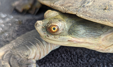
- The ‘freshwater turtle movement in the Gwydir’ project continued. The first year of the project has established that turtles move mostly in Spring, can pass regulator structures and may migrate from wetlands to rivers. Collaboration with the University of New England.
- The ‘environmental flow requirements for stream frogs’ project continued. Stream frog flow requirements have been developed to assist with the evaluation of the environmental outcomes for frogs in unregulated river water sharing plans.
- The ‘frog environmental DNA development’ project, a collaboration with the University of Canberra to develop environmental DNA capabilities for 30 frog species in NSW commenced. This “environmental DNA library” will be publicly available for any individual or organisation to use.
- The ‘state-wide modelling of stream invertebrate responses to low flows’ project continued and showed that different assemblages of insects occur under different flow conditions changing the food resources that are available for fish and other fauna. This information will be used to evaluated and inform water sharing plans.
- The ‘linking temporal changes in stream invertebrates and flow’ project looking at species composition in relation to low flows continued. This project is situated in the unregulated water sources within the Murrumbidgee catchment and will have transferable outcomes for all similar water sources in the Murray-Darling Basin.
- The ‘Snowy River environmental flow monitoring’ project continued looking at whether stream invertebrate communities were restored after an environmental flow regime was introduced to the Snowy River and other montane rivers. Collaboration with DPE-Environment and Heritage Group.
- The ‘impact of climate change on flow and temperature regimes – effects on alpine freshwater ecosystems’ project continued to look at whether increases of water temperatures and reduced flow from climate change and water regulation will affect stream invertebrate communities and thus food availability for other fauna. Collaboration with University of Canberra and Griffith University.
- The ‘River regulation and the impact on macroinvertebrate egg laying and recruitment’ project was completed. This project looked at whether altered flow regimes in NSW’s regulated rivers limit the supply of stream insect eggs, by limiting the availability of egg laying habitat.
- The ‘Giant dragonfly – assessing environmental DNA detectability and environmental water requirements’ project continued and has successfully identified the presence of the endangered giant dragonfly in its upland swamp habitat using environmental DNA sampling.
- The ‘importance of floodplain pool habitats and hydrological regimes for fauna in the northern Murray-Darling Basin’ project continued. The project surveyed floodplain pools in the Border Rivers, Gwydir, Namoi and Barwon-Darling water sharing plan areas. Up to 50 species have been detected to be present in the pools using environmental DNA sampling, including significant native fish species like golden perch. This shows the importance of these pools as refuges for fauna and the importance of connecting up with rivers during floods.
- The ‘Great Australian Wildlife Search’ project commenced and will map the distribution and occurrence of wildlife within rivers and streams in the Murray Darling Basin, using environmental DNA with the help of citizen scientists.
- The ‘coastal freshwater turtle monitoring, using underwater videos’ project commenced. Surveying across the Manning River catchment found 66 turtles, 19 of these were the endangered Manning River turtle. This work will help us identify the significance of flows on freshwater turtles to inform the flows required to protect them.
Ecosystem processes
- The ‘Barwon-Darling/Baaka stratification: minimising persistent thermal stratification and algal blooms in weir pools’ project will recommence ongoing collection of temperature data in pools to report on the impact of flows on stratification and algal blooms in weir pools.
- The ‘spatial analysis of the influence of tributary inflows below large storages in the NSW Murray-Darling Basin’ project was completed and produced a spatial dataset (published on the SEED portal) that shows the level of river regulation, and the influence of unregulated tributaries on reducing river regulated in the Murray-Darling Basin. Collaboration with La Trobe University.
- The ‘linking flow and food web productivity in the Barwon-Darling/Baaka River’ project continued and showed increased river production (i.e. food) when water reaches high bank heights within the river channel. Collaboration with University of Canberra.
- The ‘fragmentation of drought refugia in the Barwon-Darling/Baaka River’ project was completed and demonstrated that satellite imagery could be successfully used to map drought refugia to inform implementation of temporary water restriction conditions.
- The ‘potential available fish habitat in the Barwon-Darling/Baaka – analysis of current and future flow management rules’ project was completed and has produced FHabULOUS – ‘Fish Habitats Under Lots Of Unusual Scenarios’ a spatial tool to identify the location of large woody debris and river bank benches in the Barwon-Darling river system that act as valuable fish habitat.
Water dependent native vegetation
- The ‘determining the baseline (current) condition of key water dependent woody vegetation communities in the lower Namoi and lower Border Rivers’ project continued and further developed a current baseline condition of key water dependent native vegetation communities in these catchments for measuring ecological condition change in the future.
- The ‘monitoring the woody vegetation communities of Toorale National Park’ project commenced and collected information on the condition and demographics of the Coolibah woodland and Lignum shrublands of Toorale National Park in the Intersecting Streams. This information forms a baseline for measuring ecological changes in the future. Collaboration with DPE-Environment and Heritage Group.
Groundwater dependent ecosystems
- The ‘reanalysis of the groundwater dependent ecosystems health index in the in the Murray Darling Basin’ project commenced. Collaboration with Macquarie University
- The ‘establishing the links between groundwater ecosystem health, groundwater dependent vegetation and wetland health use in the Murray Darling Basin’ project commenced in collaboration with Macquarie University.
- The ‘developing a method using environmental DNA in groundwater to detect tree water use in the Murray Darling Basin’ project commenced in collaboration with Macquarie University.
- The ‘predicting the impacts of groundwater drawdown on groundwater ecosystems’ project (ARC Linkage LP190100927) commenced in collaboration with Macquarie University and University of New South Wales.
Annual reports
The annual reports for 2022-2023 will be available on the website.
You can read reports for 2021-2022:
- Annual Environmental Outcomes Monitoring and Research Program report – floodplain connectivity and inundation 2021-22
- Annual Environmental Outcomes Monitoring and Research Program report – water dependent fauna 2021-22
- Annual Environmental Outcomes Monitoring and Research Program report – ecosystem processes 2021-22
- Annual Environmental Outcomes Monitoring and Research Program report – water dependent native vegetation 2021-22
- Annual Environmental Outcomes Monitoring and Research Program report – groundwater dependent ecosystems 2021-22
Publications
For more details on specific projects, see our document library for our surface water-related publications.