About the Manning catchment
The Manning catchment is on the NSW mid-north coast and has an area of about 8,420 square kilometres.
It is bordered in the north-east by the Hastings catchment, in the north by the Macleay catchment, in the north-west by the Namoi catchment, in the south-west by the Hunter, and to the south by the Karuah catchment.
Rivers and tributaries
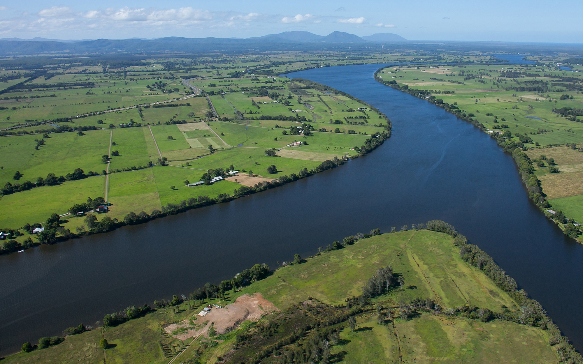
The Manning River flows for 250 kilometres, rising in the Great Dividing Range and flowing south-east through a coastal floodplain to Taree where it splits in 2. The southern arm meets the Pacific Ocean at Old Bar, and the northern arm is joined by the Dawson and Landsdowne rivers, meeting the ocean at Harrington.
Other major tributaries include the Avon, Rowleys, Nowendoc, Barnard, Little Manning, Barrington and Gloucester rivers. The Lower Manning River is a delta system with several channels creating large islands like the Mitchells and Oxley islands.
Water storages
The largest water storage in the area is Bootawa Dam, which is an off-stream dam with a capacity of 2200 megalitres. Water is drawn from the Manning River and stored in the dam, which is around 5 kilometres south of Wingham.
Towns
Most residents of the catchment live in Taree and Wingham. Gloucester and Walcha are also major towns in the Manning catchment.
Water users
Major water users relying on the catchment's rivers and estuarine resources include local councils, water utilities, conservation, dairy farming, oyster farming, coal mining, gravel extraction, manufacturing, agriculture, forestry, fisheries and tourism.
Much of the middle and lower sections of the catchment are highly fertile due to the weathering of volcanic deposits in elevated areas.
About 22 per cent of the catchment is heavily timbered and managed by the Forestry Corporation of NSW for forestry, recreation, education, research and environmental purposes. Most of the forested areas are located on relatively steep country.
Major issues include high bacteriological levels in the Gloucester River at Gloucester, loss of riparian vegetation, with altered stream form and subsequent loss of water storage during droughts.
Due to a high density of rural settlement, the region's rivers and estuaries tend to be affected by changed run-off conditions caused by land clearing, agricultural use, human settlement and recreation.
Most of the rivers and creeks in the Manning River basin are unregulated, with no major storages to capture and control flows. Most water users rely on natural flows or small structures, such as weirs for their water supplies. As in most unregulated rivers, flows are most affected during relatively dry times, when water is low and demand high.