About the Upper Murray
The Upper Murray catchment is a major contributor to water flows in the Murray River.
The Upper Murray catchment is located in southern NSW along the NSW-Victoria border. It borders the upper reaches of the Murrumbidgee catchment to the north. It contains the headwaters and unregulated rivers that flow into the Hume Dam, the main storage on the Murray River.
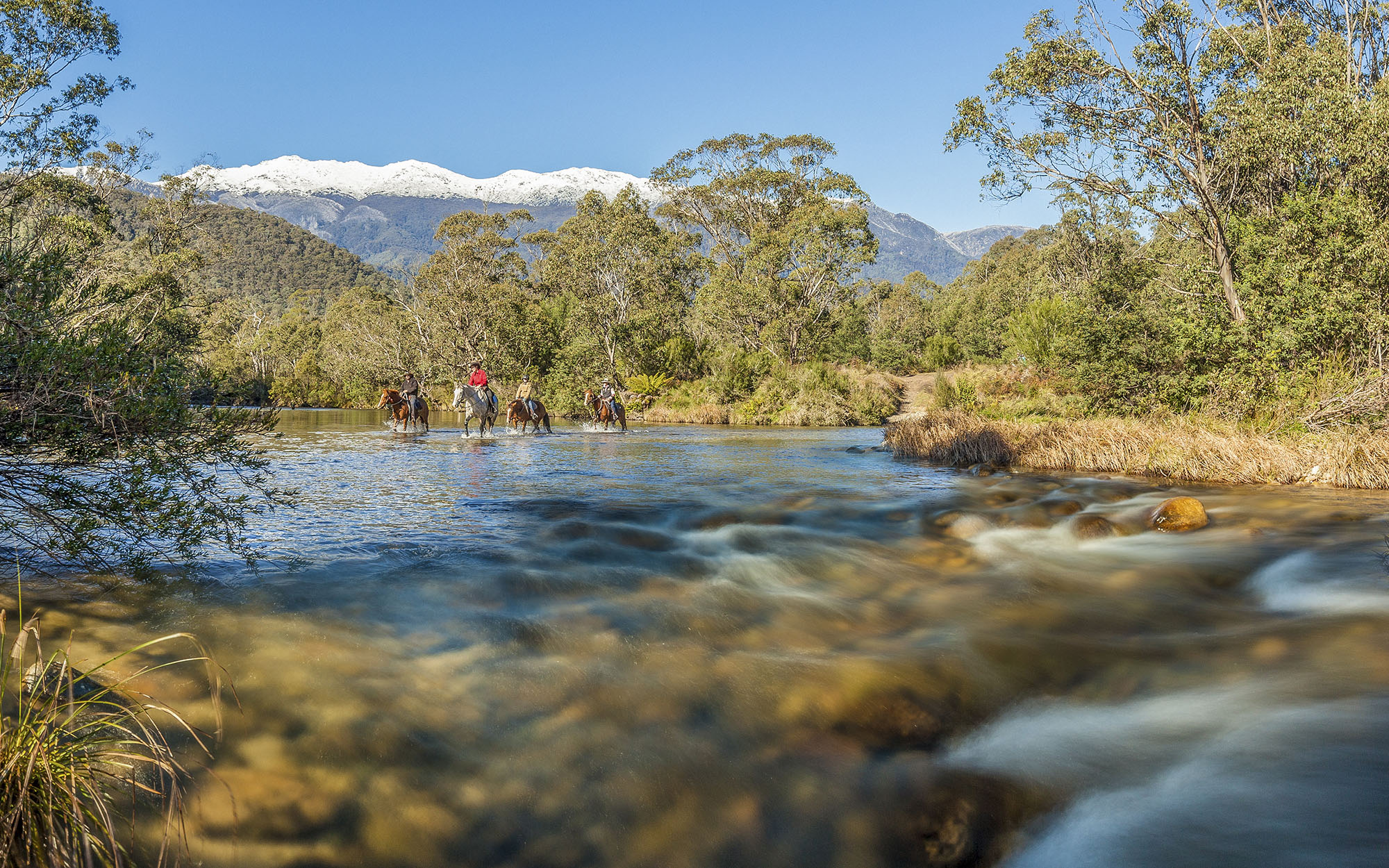
The Murray River begins its course among the high mountain peaks of Mount Kosciusko and Mount Jagungal in the Snowy Mountains, and marks the border between NSW and Victoria through to the Hume Dam. The Upper Murray is a rugged and mountainous catchment that supports vast areas of wilderness and important alpine habitats.
The Upper Murray catchment is 15,330 square kilometres in total. The NSW portion of the catchment makes up one third of this area, or 5,200 square kilometres. Elevations across the catchment range from 2,200 metres around the alpine peaks in the east, to 150 metres at Hume Dam.
Tumbarumba and Khancoban are the largest towns in the NSW portion of the catchment. The catchment is overall sparsely populated.
Rivers and tributaries
The Murray River flows from the Snowy Mountains, along the NSW-Victoria border and through south-eastern South Australia to Lake Alexandrina where it meets the Southern Ocean. The Upper Murray River covers less than 1.5 per cent of the area of the Murray-Darling Basin, but contributes 37 per cent of total inflow to the Murray River in an average year.
Major NSW tributaries to the Upper Murray include the Geehi, Swampy Plains and Tooma rivers and Tumbarumba Creek. The major Victorian tributary is the Mitta Mitta River which enters Hume Dam near Tallangatta.
Water storages
The Hume Dam, at 3,038,000 megalitres, is the main operational storage for the Murray River. It has been supplying regulated water to the Murray River system since it was completed in 1936.
Dartmouth Dam at 3,906,000 megalitres, on the Mitta Mitta River in Victoria, is the largest storage in the catchment. It is operated in conjunction with Hume Dam to supply water users along the Murray River.
Three smaller storages, Khancoban Pondage, Geehi Reservoir and Tooma Reservoir, are located in the NSW portion of the upper reaches of the catchment. They receive transfers of water from the Snowy Mountains Scheme for release to the Murray and Murrumbidgee valleys.
Water users
Major water users within the catchment include Snowy Hydro Ltd, local councils and water utilities, and sheep and cattle graziers. Over 60 per cent of the Upper Murray catchment is used for forestry or conservation. The next most extensive land use is grazing.
Water from the catchment also supplies major irrigation industries along the Murrumbidgee and Murray to South Australia, as well as to all the towns located on the river, including Adelaide.
Kosciuszko National Park is the largest conservation area in the Upper Murray catchment covering around a quarter of the NSW portion. It is recognised nationally and internationally as a UNESCO Biosphere Reserve, and preserves extensive areas of wilderness.
The alpine wetlands within the national park are of national and international importance. Blue Lake is listed under the Ramsar Convention and all of the alpine fens, bogs and lakes within the park are listed in the Directory of Important Wetlands in Australia.
Water resources are shared between NSW, Victoria and South Australia under the Murray-Darling Basin Plan. Sharing water resources fairly between the states, particularly during drought, is a key water management issue.
The Upper Murray catchment receives transfers of water from the Snowy Mountains Scheme via Geehi Reservoir and Khancoban Pondage while water from Tooma Reservoir is transferred out of the catchment to the Tumut River.
Most rivers and creeks in the Upper Murray catchment are unregulated and water users rely on natural flows or small structures, such as weirs for their water supplies. River flows are variable and during drought conditions natural river flows may cease, reducing the amount of water available to be shared between competing users.
Rainfall run-off patterns in NSW are likely to vary as a result of climate change, and we are working to ensure our water management strategies reflect this, particularly for drought periods.