About the Coastal Floodplain Drainage Project
What is the Coastal Floodplain Drainage Project?
The Coastal Floodplain Drainage Project commenced in 2019 and is one of several Marine Estate Management Strategy (MEMS) projects improving the health of coastal floodplains and estuaries in NSW. The objectives of this project are to improve the regulatory framework for coastal agricultural drainage works and activities by:
- addressing the complexity, time and costs associated with the approvals process
- reducing the impact of these works and activities on downstream water quality, aquatic ecosystems, communities and industries.
The project’s focus is NSW coastal floodplains with extensive agricultural drainage systems, focused on the Tweed, Richmond, Clarence, Macleay, Hastings, Manning and Shoalhaven rivers.
The Water Group leads the project as part of an interagency working group with representatives from NSW Government agencies including; Planning, Crown Lands, and Environment and Heritage divisions, and the Department of Primary Industries – Fisheries.
What is the Coastal Floodplain Drainage Options Report?
The NSW Government has developed a report on options for reform of the regulatory framework for coastal agricultural drainage works and activities. The options are evidence-based and take account of social, cultural, economic and environmental interests, the project objectives, and stakeholder views expressed during consultation in 2020 and 2021.
The Coastal Floodplain Drainage Option Report PDF, 701.29 KB was released on 18 December 2023. In early 2024, we will be seeking feedback on the report from individuals, communities, councils, industries, Aboriginal groups, and environmental advocates.
The NSW Government has not identified a preferred approach at this stage. We want to first consider stakeholder feedback about how the options would work in practice before forming a view.
What are the options proposed in the options report?
The six options proposed in the report are:
Option 1: One-stop shop webpage
A single source of information on the various approvals that may be required by government agencies for coastal floodplain drainage works.
Option 2: Drainage applications coordinator
A central officer(s) to guide an applicant through the approvals processes for all NSW government agencies (Water Group, Planning, Crown Lands, and the Department of Primary Industries — Fisheries) and answer the applicant’s questions about their individual location and proposed works. The drainage applications coordinator would complement both Option 1 and Option 3.
Option 3: Concurrent assessment
Concurrent assessment of applications by relevant government agencies. This would involve consolidating the information required under multiple approvals to be submitted as one integrated development application. While proponents would still need to separately apply for public authority approvals, their determination could be expedited, as the required information and assessment could occur as part of the integrated development process.
Option 4: Risk-based approach
NSW Government agencies would use a standardised risk matrix to compare the type and extent of the drainage works against the acidic water and blackwater potential of the drainage area to identify the level of risk associated with the proposed works. The identified level of risk could then be used to determine:
- the level of information required from applicants
- the level of assessment required by the approval authority
- the types of conditions applied to any approvals.
Option 5: Drainage work approvals under the Water Management Act 2000
Switch on drainage work approvals under the Water Management Act 2000. Two different methods of implementation are possible:
- a drainage work approval would be required only when works are proposed and for the area of works only
- a drainage work approval could apply to existing and new drainage works across the entire drainage network.
Within either of these two methods, one of three different approaches for public authorities could be applied:
- require public authorities to hold a drainage work approval
- allow for public authorities to hold a conditional exemption from requiring approvals
- exempt public authorities from requiring a drainage work approval.
Option 6: Streamlining of Fisheries and Crown Land approvals through the use of drainage work approvals
- Drainage work approvals, particularly under Option 5(ii), have the potential to deliver a catchment-wide consideration of the drainage network. This would provide greater certainty to other agencies, such as Crown Lands and Fisheries, that environmental impacts have been considered and appropriate conditions applied, supporting them to assess and issue approvals more quickly.
Each of the options could be implemented independently (except for Option 6) or in combination with others.
What is coastal floodplain drainage?
A coastal floodplain is the low-lying, generally flat land surrounding an estuary. In their natural state, coastal floodplains flood during high tides or after heavy rainfall.
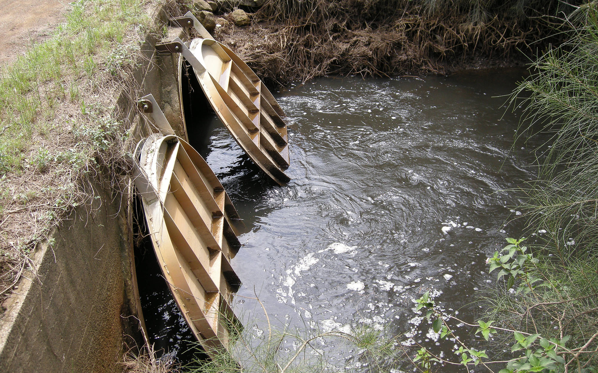
Many coastal floodplains were artificially drained and floodgates installed in the 1900s to keep out high tides. This network of drains (some artificially constructed and others natural or modified watercourses) and floodgates is what is referred to as coastal floodplain drainage.
Drainage has allowed these areas to be used for many purposes, including urban development and agriculture including growing sugar cane, cattle grazing, dairy farming, and horticulture.
What are the main water quality impacts from coastal floodplain drainage?
The water drained artificially from coastal floodplains can cause water pollution under certain conditions. This can have a negative impact on the health and biodiversity of the estuary and on water quality. It can also impact downstream ecosystems, communities, and industries such as fishing and tourism.
The most significant water quality problems are acidic and deoxygenated water.
Acid sulfate soils are extremely acidic soil layers that are common and naturally occurring on NSW coastal floodplains. Where these soils are present, sulfuric acid begins to form when soil profiles are exposed to air after floodplain drainage is installed or maintained. When it rains, this acid is mobilised from soils and drains into the river and estuary through the drainage systems. The water can be as low as pH 3, which dissolves many heavy metals from the sediment and is toxic to fish.
Introduced non-water tolerant vegetation decomposes when inundated during flood events, and this process uses up the oxygen in the water. Monosulfidic black ooze (known as MBOs) also develops in some of these areas. Both conditions can cause widespread deoxygenation of estuaries and fish deaths.
What is the regulatory framework for coastal floodplain drainage works and activities and why is it complex?
Works and activities associated with coastal floodplain drainage infrastructure, including maintenance, are regulated under several pieces of legislation, which can be complex to navigate.
This includes approvals or assessments under the:
- Environmental Planning and Assessment Act 1979
- Fisheries Management Act 1994
- Crown Land Management Act 2016
- Water Management Act 2000
- Marine Estate Management Act 2014.
Approvals that may be required include development consent, controlled activity approvals, Fisheries permits, Marine Park permits, Crown Lands landowner’s consent and Crown Lands licences.
In rare circumstances, approvals may be required under other legislation including the Biodiversity Conservation Act 2016.
What is meant by the term drainage work(s)?
Drainage work(s) is used to refer to both the infrastructure or structures used for drainage on the coastal floodplain, which includes floodgates, drains and drain outlets, as well as activities carried out on this infrastructure such as clearing a drain or drain outlet.
What has already been done to improve awareness and coordination of approval requirements?
Planning has published a development referrals guide to help local councils and applicants understand if their development application requires input from another agency (e.g. integrated development) and the type of information that needs to be lodged with a development application.
Planning has published Guidelines for Division 5.1 assessments that explain what proponents and determining authorities need to do to undertake a Division 5.1 assessment (i.e. a Part 5 assessment under the Environmental Planning and Assessment Act 2000).
In 2021-22 Crown Lands improved its licensing processes, and additional improvements are anticipated. The short-term Crown Land licence application form is now online, making it easier and faster to lodge. These short-term licence applications are now processed in about 2 to 3 months. Where a strong case for urgency is presented, applications can be triaged for priority.
Fisheries has also implemented several changes to simplify and reduce the number of individual Fisheries permit applications required for routine, low-risk activities.
These reforms include introducing:
- codes of practice and best practice agreements, including pre-approved work methodologies, assessment procedures, protocols for opening and closing floodgates and review mechanisms
- long-term maintenance permits (up to 5 years) for multiple sites for local councils/ public authorities
- issuing of Fisheries permits prior to landowner consent.
Environmental Planning and Assessment Act approvals
Will guidance be provided on the NSW planning pathways?
Yes, we understand that councils and farmers have requested further information on:
- the interaction between Chapter 2 (Coastal Management) of State Environmental Planning Policy (Resilience and Hazards) 2021 (Resilience and Hazards SEPP) and the State Environmental Planning Policy (Transport and Infrastructure) 2021 (Transport and Infrastructure SEPP) for flood mitigation works in mapped coastal wetlands/littoral rainforests
- clarification on the definition of ‘routine maintenance’ under the Transport and Infrastructure SEPP for flood mitigation works
- the approval requirements:
- for different farming industries conducting drainage works on acid sulfate soils
- under the Resilience and Hazards SEPP for environmental protection works carried out by public authorities, including local councils, in mapped coastal wetlands/littoral rainforests
- under the Transport and Infrastructure SEPP for environmental management works (which includes environmental protection works) (outside mapped coastal wetlands/littoral rainforests) carried out by public authorities.
Planning will assist councils in navigating the NSW planning system and intends to provide guidance on the above matters.
Crown Lands Management Act approvals
When is Crown Lands approval required?
Most regional waterways, estuaries and associated tributaries are public Crown land, owned and managed for the people of NSW under the Crown Land Management Act 2016.
Crown Lands must ensure that environmental, social, cultural heritage and economic impacts have been considered, and appropriate conditions have been applied to works requiring authorisation on Crown land. For most coastal floodplain drainage works, this occurs by issuing a Crown Land licence.
Why do Crown Lands approvals take time and what improvements has Crown Lands made to reduce processing times?
Long-term licences take longer to process than short-term licences. More in-depth assessment is required for long-term licences because there is greater potential for negative impacts associated with the proposed activity/works. Licence applications for Crown land affected by the Commonwealth Native Title Act 1993, or subject to a claim under the Aboriginal Land Rights Act 1983, may also have notification and consultation requirements. Also, processing times can increase when an application is incomplete or has inadequate information.
In 2021-22 Crown Lands improved its licensing processes and additional improvements are anticipated. The short-term Crown Land licence application form is now online, making it easier and faster to lodge. These short-term licence applications are now processed in about 2 to 3 months. Where a strong case for urgency is presented, applications can be triaged for priority.
Fisheries Management Act and Marine Estate Management Act permit/s
What are the current approvals for floodplain drainage works under the Fisheries Management Act 1994 and Marine Estate Management Act 2014?
Fisheries permits under the Fisheries Management Act 1994 and Marine Parks permits under the Marine Estate Management Act 2014 are issued for:
- dredging or reclamation,
- harming marine vegetation (key fish habitat) on public water land and adjacent foreshore, including private land, up to the highest astronomical tide, or
- obstruction of fish passage within key fish habitat areas.
Key fish habitat is generally the length of the ‘drain channel’ downstream of the most downstream (end-of-system) floodgates but may also extend upstream of a floodgate where the floodgate is located on a natural waterway.
The requirement to hold a Fisheries dredging or reclamation permit depends on who is doing the work and what other approvals are required, to avoid duplicating approvals across the various legislative requirements. A Fisheries permit for harm to marine vegetation is always required when the applicant proposes to harm marine vegetation.
What are DPI Fisheries doing to reduce regulatory complexity for floodplain drainage works?
From receipt of a complete application, the processing time for a Fisheries permit is 28 days. Longer processing times can occur when an application is incomplete or has inadequate information.
Fisheries has also implemented several changes to simplify and reduce the number of individual Fisheries permit applications required for routine, low-risk activities. These reforms include introducing:
- codes of practice and best practice agreements, including pre-approved work methodologies, assessment procedures, protocols for opening and closing floodgates and review mechanisms
- long-term maintenance permits (up to 5 years) for multiple sites for local councils/public authorities
- issuing of Fisheries permits prior to landowner consent.
When codes or agreements exist, fewer approvals are required by Fisheries, which reduces processing time. These changes have improved the regulatory framework and provide for easier operation for public authorities.
Current legislation already provides some exemptions from approvals where there is overlapping jurisdiction. For example, a Fisheries permit for dredging activities is not required if an approval has been provided by another agency, such as Crown Lands or the Water group, because a referral to Fisheries is included in the assessment process.
How will the proposed ‘Option 6: Streamlining of Fisheries and Crown Land approvals through the use of drainage work approvals’ change the current Fisheries approvals?
Commencing drainage work approvals could provide an opportunity to further streamline the regulatory framework, and potentially allow DPI Fisheries to assess and determine applications faster. This is because drainage work approvals (particularly under Option 5(ii)) could consider water quality at a drainage network or sub-catchment level. This holistic approach could enable greater certainty to other agencies that the potential environmental impacts have been considered and appropriate conditions applied.
How will DPI Fisheries (and other government agencies) use the Coastal Floodplain Prioritisation Study?
The Coastal Floodplain Prioritisation Study has been completed for the Tweed, Richmond, Clarence, Macleay, Hastings, Manning and Shoalhaven River estuaries. The Study identifies high and lower-priority (risk) areas for water quality and drainage vulnerability and provides long and short-term management options to reduce or adapt to these risks. It also collates relevant information to inform floodplain land use and infrastructure management decision-making by agencies, councils, and landholders.
The Study outcomes have no direct regulatory bearing on floodplain managers and landholders, but instead provide an evidence-based resource to guide current and future floodplain management decisions. This could include ways to adapt to sea level rise or achieve improved water quality outcomes.
The government acknowledges the extensive efforts already made by many to address coastal floodplain water quality issues. The results of the Study highlight persistent acidic water quality and episodic, but catastrophic, blackwater risks, and emerging threats from sea level rise. We know these present significant challenges and are committed to working with stakeholders and landholders to address these and develop solutions.
The Study reports are available on the MEMS website.
Water Management Act 2000 approvals
When is a controlled activity approval required for coastal floodplain drainage works under the Water Management Act 2000?
A controlled activity approval is required to carry out activities on waterfront land unless an exemption applies. Waterfront land is defined as the bed of any river, lake or estuary, and the land on each side within 40 metres of the riverbank, lake shore or estuary’s mean high water mark.
For coastal floodplain drainage works, a controlled activity approval is required where any works, such as the removal of sediment, are proposed on waterfront land. This definition applies to some existing drainage channels where the drain is classified/categorised as a natural channel, or a natural channel artificially altered.
What other approvals are there under the Water Management Act 2000 to improve the regulation of coastal floodplain drainage?
The Water Management Act (WM Act) also provides for drainage work approvals, but these provisions have not been switched on. Option 5 considers turning on the provisions in the WM Act that require a landholder to hold a drainage work approval. This approval would be required to construct and use a drainage work, which includes drainage channels (whether they are artificial, modified or unmodified watercourses) and floodgates.
If this were to occur, the drainage work approval would become the most appropriate approval type under the WM Act and replace the requirement for a controlled activity approval. This would simplify the process of understanding where WM Act approvals are needed, as it applies to all floodplain drainage infrastructure, including drains and floodgates.
There are two main ways that the drainage work approval could be implemented (Option 5):
- a drainage work approval would be required only when drainage works are proposed and for the area of works only, or
- a drainage work approval could apply to existing and new drainage works across the entire drainage network.
Compared to Options 1–4 that operate within the existing regulatory framework, drainage work approvals would provide a fit-for-purpose approval under the WM Act that can address water quality impacts and possibly allow further streamlining as outlined in Option 6. To read more, see the question ‘How will the proposed ‘Option 6: Streamlining of Fisheries and Crown Land approvals through the use of drainage work approvals’ change the current Fisheries approvals?’.
Complementary NSW Government programs
How is the Blue Carbon Strategy relevant to coastal floodplain drainage?
Projects that are reinstating tidal flows may be eligible for Australian Carbon Credit Units. To find out more, visit NSW Blue Carbon Strategy | NSW Environment and Heritage.