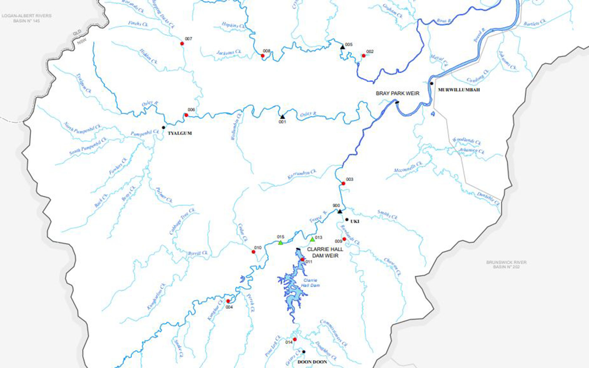
This series of maps shows water monitoring stations (gauging stations) across New South Wales. This series, formerly known as the Pineena maps, was created as part of a major project in 2011.
Each map includes stations in the following categories:
- Current with significant data:
Gauging stations that were active and have significant data or had been established as of March 2011. - Current without significant data:
Gauging stations that were active but didn't have significant data as of March 2011. - Discontinued or moved:
Gauging stations that have been closed or moved to another organisation to maintain as of March 2011.
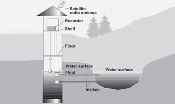
What is a water monitoring station?
A water monitoring station (also known as a gauging station) is a location on a stream, canal, lake or reservoir where an observer or tool takes readings of the gauge height or discharge.
Hydrologists use these continuous records to make predictions and decisions concerning water level, flood activity and control and navigation.