About Mundowy Lane works and measures package
A package of early works and other measures are currently being scoped for Mundowy Lane that will improve access during periods of higher river flows including higher environmental flow options being considered by the program.
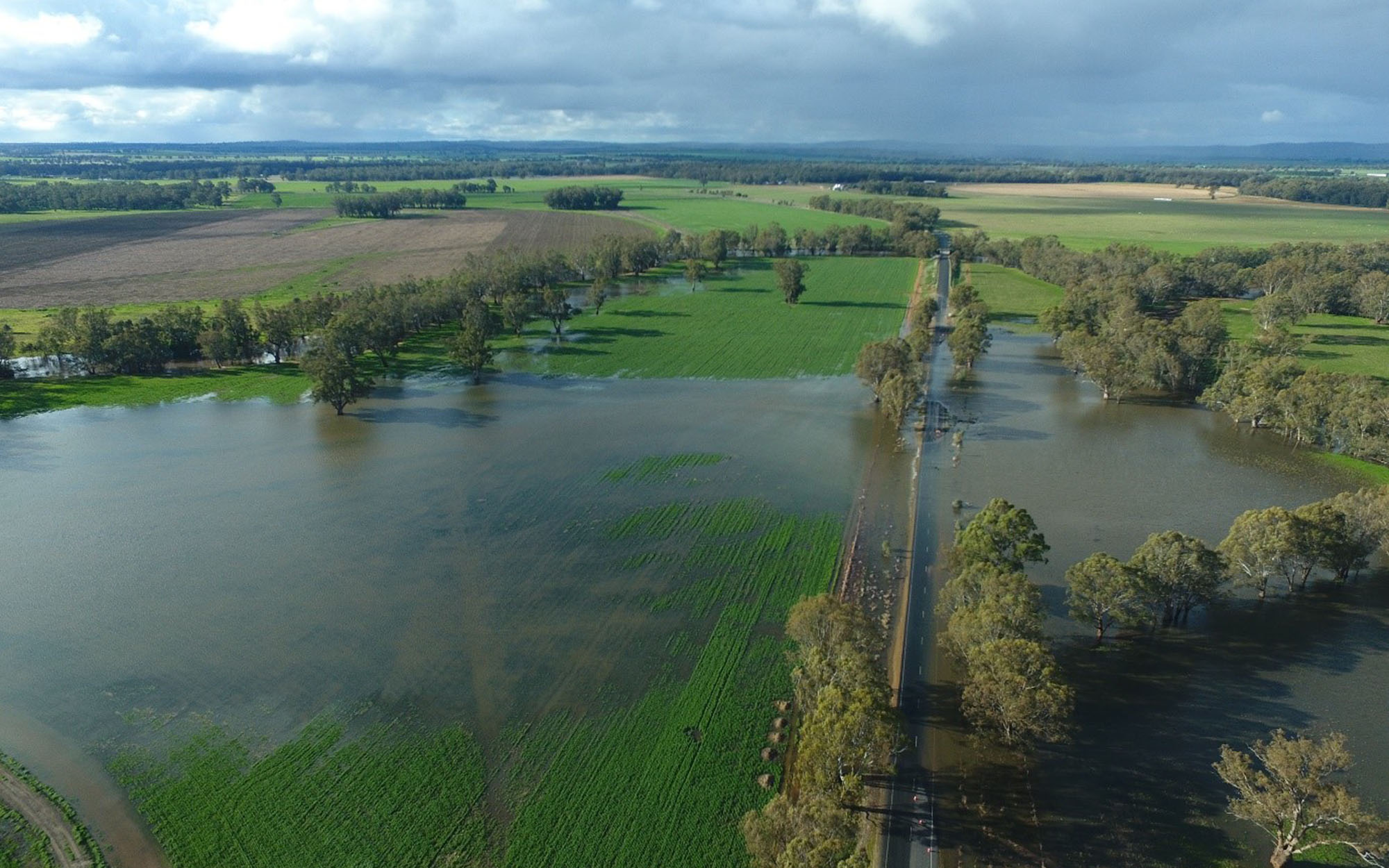
Mundowy Lane is an important arterial road crossing Beavers Creek and the Murrumbidgee River, near the township of Collingullie.
Due to the current height of the southern section of Mundowy Lane, between the Sturt Highway and Beavers Creek, flows of 35,000 ML/day (5.51m) at Wagga Wagga see water beginning to cross over the road reducing traffic to a single lane rather than two lanes. At 44,000 ML/day (6.44m) at Wagga Wagga, the road is closed causing detours of up to 50km for local traffic.
The program has identified the road as a barrier to delivery of higher environmental flows and is scoping a package of early works to raise its southern section. The road is owned, operated and maintained by Wagga Wagga City Council.
The program is considering raising the southern section of Mundowy Lane to a level that will prevent inundation during flows up to 45,000 ML/day at Wagga Wagga.
New culverts could be placed in the raised roadway allowing the passage of higher flows underneath and reducing the risk of damage to the road.
Benefits of the works and measures
The potential benefits of the proposed early works could include:
- enable vehicle passage along Mundowy Lane during proposed higher environmental flows
- less overtopping of the Mundowy Lane in times of natural high flows, resulting in less disruption to local communities
- eliminating the need for traffic control and lane closure with flows up to 45,000ML/day
- less servicing and maintenance of the road and road verges
- contributing to the broader program delivery that will benefit wetlands and floodplains downstream and improving river and wetland health.
Early works and measures limits
The frequency of managed environmental flows, enabled by the program, would vary over time depending on water availability, climate conditions, ecological priorities, and consideration of risks and impacts. These higher environmental flow deliveries would not occur during extreme wet conditions when there is elevated flood risk.
This package of works and measures will be designed to mitigate against flows up to, and including, the highest flow option (with buffer) being considered by the program. The package will not be designed to mitigate against natural flow events above this level.
Mundowy Lane early works and measures scoping
The Water Group in the NSW Department of Climate Change, Energy, the Environment and Water will lead the preliminary heightened road design and hydraulic modelling work.
Engagement with stakeholders and First Nations groups will play an important part in the package’s development.
Scoping activities will include:
- initial stakeholder and First Nations engagement
- developing an Aboriginal Cultural Heritage Assessment Report and necessary site investigations with Traditional Owners
- review and undertake ecological, Aboriginal heritage and environmental studies
- undertaking geotechnical investigations and hydraulic modelling to inform works design
- concept designs and cost estimates of works.
Consideration of raising the road above major flood level is out of scope.
Contact us
For more information call us on 1300 081 047 or email us at: admin.rrcp@dpie.nsw.gov.au