Flow options
The timing, frequency, extent and duration of environmental flows has a powerful effect on the landscape and the thousands of species calling it home.
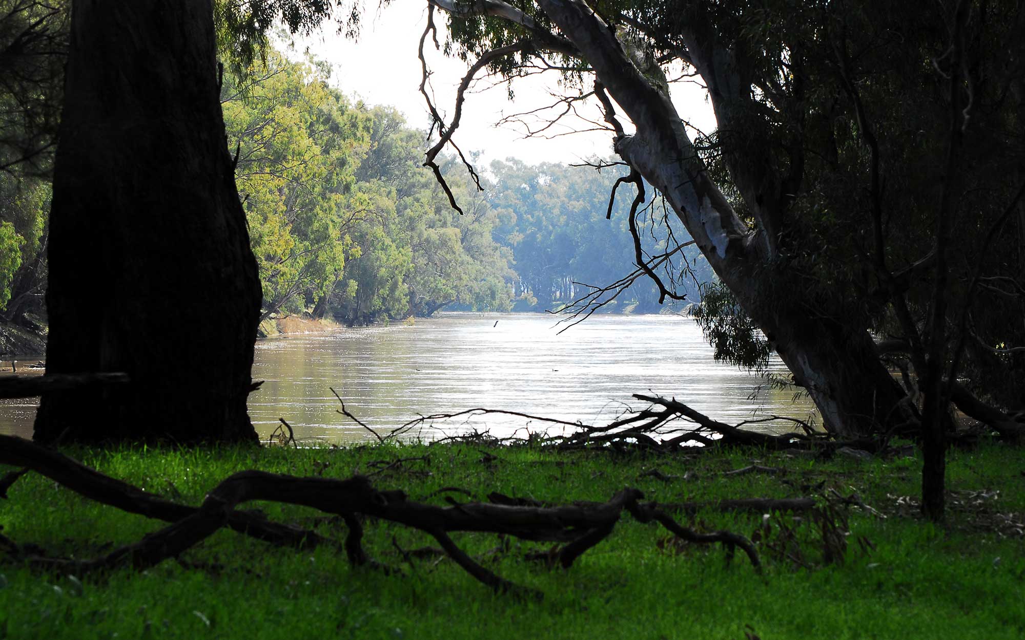
Smaller flows stay within the river channel. Slightly higher flows reach higher up channel banks, and in some areas, spread into floodplain creeks and billabongs; reconnecting the wetlands and providing important habitat for wildlife.
Current limits on releases for environmental flows in the Murray and Murrumbidgee Rivers are capped at relatively low levels. This means rivers and floodplains are connecting less often than they once did and need to be.
The Reconnecting River Country Program is currently in development. The program is an opportunity to consider a range of increased flow limits for releases for environmental purposes to provide greater flexibility in the Murray and Murrumbidgee River systems.
Should the program proceed to delivery, it would allow more flexibility in the delivery of flows and give water managers the ability to:
- reinstate some natural flow patterns
- trigger breeding and movement of native fish, waterbirds and other water-dependent animals
- release and transfer carbon and nutrients underpinning the aquatic food web
- enhance native fish populations and support healthy river and wetland ecosystems
- improve the health of forests, woodlands and shrublands along river corridors and on low-lying floodplains.
Flow limits being assessed
Flows of different sizes and duration would achieve a range of outcomes for river and wetland health, connectivity and wildlife.
In collaboration with stakeholders, the program is assessing a range of flows to investigate benefits, costs and risks to make evidence-based decisions on preferred flow limits across the program areas.
The flow options being investigated will be used as the basis for:
- modelling inundation footprints
- assessing community benefits and impacts
- assessing environmental benefits and risks
- measuring outcomes for First Nations people
- identifying opportunities and mitigation measures.
The current phase of the program involves collaboration with landholders, First Nations people, public landholders, reference groups and other stakeholder groups across the Murray and Murrumbidgee Valleys.
Through this process, stakeholders have the opportunity to provide feedback on flow limit options and mitigation measures.
The following flows limit options are currently being assessed in the Murray and Murrumbidgee program areas, noting other flows within these ranges could be explored in the future.
Murray - Hume to Yarrawonga (flows reported at Doctors Point gauge).
- 25,000 ML/d – current operational limit in the Water Sharing Plan (WSP)
- 30,000 ML/d – flow limit option
- 35,000 ML/d – flow limit option*
- 40,000 ML/d – flow limit option.
*35,000 ML/d flow options were added for both Hume to Yarrawonga, and Yarrawonga to Wakool Junction in early 2023, enabling a more robust assessment of the change in impacts and benefits across the range of flows being investigated.
Murray - Yarrawonga to Wakool Junction (flows reported at downstream of Yarrawonga Weir)
- 15,000 ML/d - current temporary operational limit
- 25,000 ML/d – flow limit option
- 30,000 ML/d – flow limit option
- 35,000 ML/d – flow limit option*
- 40,000 ML/d – flow limit option
- 45,000 ML/d – flow limit option.
*35,000 ML/d flow options were added for both Hume to Yarrawonga, and Yarrawonga to Wakool Junction in early 2023, enabling a more robust assessment of the change in impacts and benefits across the range of flows being investigated.
Murrumbidgee River (flows reported at Wagga Wagga)
- 22,000 ML/d (current temporary operational limit)
- 32,000 ML/d – flow limit option (current operational limit at Gundagai in the WSP)
- 36,000 ML/d – flow limit option
- 40,000 ML/d – flow limit option.
Understanding flow options
Timing of flows
To maximise the environmental benefit of flows, water managers schedule water deliveries to support specific ecological outcomes, such as native fish breeding, waterbird nesting and river productivity.
The timing of environmental flows needs to align with the lifecycle requirements of these native plants and animals.
Environmental flows are scheduled to:
- trigger native fish and other wildlife to breed
- encourage food production in rivers and wetlands
- open additional habitat for nesting, foraging and feeding
- provide essential nursery habitat for a variety of wildlife.
Flows can also be delivered to provide drought refuge (i.e., river or wetland environments providing habitat for wildlife during extended dry spells).
When planning the delivery of water for the environment, environmental water managers and holders consider the:
- availability of water in dams and river systems
- condition of the target site and catchment prior to a proposed event
- current health of the native plants and animals in the target ecosystem
- current river flows which may influence delivery of water for the environment
- forecasted weather events with the potential to influence river flows
- needs and input of landholders whose properties are located along the flow corridor.
The program is currently in development. Should it proceed to delivery, flow releases enabled by the program would often occur in response to a natural trigger, such as rainfall or inflows from tributaries downstream of major dams. These flow releases would typically occur in winter or spring, in line with natural flow patterns and lifecycle requirements of native plants and animals.
Most flow releases would occur from August to October, with river rises occurring slightly later in downstream areas as these flows move through the system. Occasionally releases might occur slightly earlier in May to July, or slightly later in November. Releases in November would be infrequent and would mostly involve augmenting an existing flow event to improve environmental outcomes or manage hypoxic blackwater risk.
Water for the environment may be released soon after rain or a natural inflow event to build on the event (if there is little risk of exceeding the flow limit), or later when the peak has passed to slow the rate of fall (recession) and maintain water in priority wetland areas.
The management of water for the environment is adaptive, meaning flows are closely monitored as they progress and adjustments are made to accommodate changes in weather, inflows or other factors.
Frequency
The frequency of environmental flows is guided by the needs of the environment. These needs are reflected as environmental water requirements detailed in Long Term Water Plans. The plans help inform the management of water for the environment over the longer term.
The frequency of flows depends on a range of factors. Water managers work closely with river operators, researchers, community advisory groups, landholders and other stakeholders to decide where and when water for the environment can deliver the best possible outcomes.
For instance, water for the environment may be added to a natural event to extend the area or duration of inundation. Another factor is the landscape itself. The lowest lying wetland and floodplain areas may require a period of inundation almost every year or every second year. Alternatively, areas of slightly higher ground may require inundation less often (i.e., every second or third year).
While natural high flow events meet some of these needs, in many cases smaller sized events are required more often to support wetland plants and provide regular opportunities for native fish and other aquatic life to move between rivers and wetlands to breed and grow.
The frequency of higher flows is targeted at supporting the natural cycle of floodplain forests and woodlands and are important for waterbird breeding. They also boost aquatic food webs, which are key to making sure native fish, waterbirds and other animals have enough food to thrive.
The frequency of managed environmental flows, enabled by the program, would vary over time depending on water availability, climate conditions, ecological priorities, and consideration of risks and impacts. These higher environmental flow deliveries would not occur during extreme wet conditions when there is elevated flood risk.
On average, it is anticipated these managed environmental flow deliveries would occur about five years per decade, comprising some smaller events and some larger events up to the flow limit. In some decades (e.g., very wet or very dry) there would likely be fewer deliveries (possibly two or three per decade). In other decades there may be more deliveries (possibly seven per decade), comprising some smaller events and some larger events up to the flow limit.
Managed flow events and the associated low-level inundation of private land may follow an irregular pattern. For example, events may occur over consecutive years followed by a break of one or several years, depending on factors such as when the natural triggers occur, environmental watering priorities and water availability.
Extent of flows
Should the program proceed, relaxing constraints would allow water managers to periodically deliver flows to wetlands and low-level floodplain vegetation communities that can’t be watered at present. This would increase ecological outcomes and help to rehabilitate struggling areas that have not seen the frequency of flows needed to support healthy and resilient ecosystems.
Before river regulation, these areas received more frequent flows supporting the health of extensive areas of wetlands, river red gum and black box forests and woodlands and other wildlife.
The program has published mapping showing the expected upper limit of inundation associated with each of the flow limits being assessed.
View proposed flows at inundation mapping.
Duration of flows
The duration of managed flow events in rivers varies. The program is preparing information on the expected duration of different sized flows at key river gauges so stakeholders can see the expected pattern of flows near them under a range of flow limit options.
If the program proceeds, event durations would be guided by water requirements established in Long Term Water Plans but would also depend on water availability, the time of year, existing catchment and ecological conditions and watering requirements at the time of the event. The duration would also vary between valleys and locations in valleys. Wetlands would retain water for longer than floodplains that shed water back to the river as flows recede.
The length of time private property would be inundated during these events would vary depending on the elevation and geography of the land, for example wetlands would retain water for longer than floodplains that shed water back to the river as flows recede.
Modelling to inform decision-making
Interactive inundation mapping
In July 2022, the NSW Government released improved online inundation modelling for the program area. These interactive maps show the estimated upper limits of inundation if there was a change in flow limit consistent with the options being considered by the program.
Inundation modelling of the program area has been developed using comprehensive hydraulic modelling, which was checked against satellite imagery and aerial photography collected during several recent high flow events in the Murray and Murrumbidgee valleys. The modelling gives stakeholders a better understanding of the land likely to be inundated during higher flow events and demonstrates the likely benefits and impacts of different flow levels.
Two types of maps are now available:
- interactive, online maps for the entire program areas showing the estimated upper limits of inundation associated with the flow options being considered by the program
- higher resolution property-scale maps are also available for impacted landholders through an application process
- these property-scale maps include information such as property boundaries and infrastructure, aerial imagery and property-scale inundation
The maps are a major improvement on the modelling used for previous constraints management projects and are the result of a significant investment by the Australian and NSW Governments.
Their development involved an extensive data collection program providing high quality data inputs to model development and calibration, as well as desktop checking against available aerial photography and satellite imagery. Further work is required to ground truth and validate these provisional products with landholders and stakeholders, and mapping will be updated over time in response to this feedback and refinement.
To view the maps, visit the program’s inundation mapping.
Landholder engagement
The program is in development and conducting landholder engagement to seek valuable feedback to help shape the program’s design.
If you are a potentially affected landholder, register to participate in the program by completing the Landholder registration form.
Inundation modelling webinar
View a recording of the program’s Introduction to modelling webinar held on 27 June 2022.
Contact us
For more information call us on 1300 081 047 or email us at: admin.rrcp@dpie.nsw.gov.au